Appalachian History
A coal obelisk in a river triangle
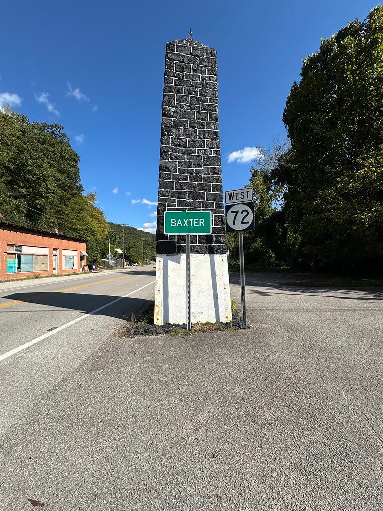
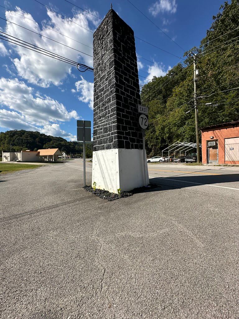
On a small wedge of ground in Baxter, just north of Harlan, a black obelisk rises beside the road. Locals call it the Coal Monument. It stands at the junction where neighborhood streets and state routes braid together near the meeting of the Cumberland River’s forks. Guides place it in Baxter along KY 72 and describe its fabric plainly: big blocks of coal, stacked and mortared, set up to honor the industry that built modern Harlan County. One common note says mines across the county contributed the coal that went into it.
The setting helps explain why the monument became a landmark. Baxter lies close to the confluence of the Clover Fork, Martin’s Fork, and Poor Fork, the three tributaries whose joining forms the Cumberland River through Harlan. The tangle of roads and bridges here made the spot a natural place for a public marker that everyone would pass. A mid-century USGS topographic sheet for the Harlan quadrangle shows the old road network through Baxter and the channels of the forks around the site.
The roads that wrapped around it
For decades travelers reached the monument along old alignments of US 119 and US 421. Just down the way stood a Baltimore through truss bridge built by the Vincennes Bridge Company in the 1920s. HistoricBridges identifies it as the old US 119 crossing, with the old US 421 junction at its north end. Local reporting still orients readers by that bridge when describing the monument’s location in Baxter.
The 1954 USGS map places both highways and approaches in relation to the forks, making clear how the roadway curled past the obelisk. Late twentieth century flood-control work later re-routed water and altered approaches, but the monument stayed in its familiar triangle of ground. The Army Corps of Engineers’ summary of the Harlan Flood Control Project, finished in 1999, documents these changes to channels, levees, and nearby crossings in Harlan, Baxter, Loyall, and Rio Vista.
Today KYTC’s State Primary Road System map remains the official snapshot of the county’s network and is a useful companion when reading the older sheets. It confirms current numbering around Baxter and helps translate between the historic alignments and modern roads that now funnel past the monument.
When was it built, and by whom
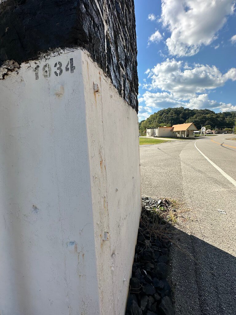
You will often see a specific date for the monument’s erection in circulation: May 22, 1932. You will also see two recurring claims about who made it happen: that it was a Works Progress Administration project and that it had backing from the Harlan Kiwanis Club. Those are tempting statements, but they must be tested against contemporary sources.
The WPA could not have built anything in 1932 because the agency did not exist until President Franklin D. Roosevelt created it by Executive Order 7034 on May 6, 1935. Any WPA credit attached to 1932 should be treated as an error until proven otherwise. The National Archives and the presidency project at UCSB both date the agency’s creation to May 1935.
The Kiwanis claim is more plausible, since civic clubs often sponsored Depression-era beautification and markers. The place to verify that is in period records. Two primary sources are ready for checking. First, the Harlan Daily Enterprisecovered local improvements and civic-club work throughout 1932, and the Kentucky Historical Society’s microfilm list confirms a complete run for that year. Second, The Kiwanis Magazine printed monthly “News of Clubs and Districts” that sometimes mention local projects; 1932 volumes are digitized and searchable on the Internet Archive. Those sources should settle the matter of sponsorship once someone pulls the right pages.
One widely shared modern write-up that repeats the May 22, 1932 date should therefore be treated as secondary until a newspaper item, club note, or county record from 1932 is in hand.
What the monument meant
Even before the coal wars of the 1930s transformed Harlan County’s national image, coal shaped nearly every mile of road and riverbank here. The obelisk compresses that story into a single vertical gesture. Tourism and roadside guides describe it in exactly those terms: a miners’ and industry tribute built of the thing itself. The idea that mines across the county contributed blocks fits the era and the county’s culture of collective display. Until primary documents confirm the list of contributors, that detail remains a well-attested local tradition.
How to visit
The Coal Monument stands in Baxter along KY 72, just off US 421 north of Harlan. Roadside America provides a crisp orientation for first-time visitors and includes recent photos and siting notes. If you explore the area, the abandoned truss span and the rebuilt approaches nearby help you read the older highway geometry that once wrapped around the monument.
Sources and further reading
USGS Historical Topographic Map, Harlan KY 7.5-minute, surveyed 1954, published 1956; and USGS program notes on the Historical Topographic Map Collection. The National Map+1
Kentucky Transportation Cabinet, State Primary Road System map for Harlan County. KYTC
HistoricBridges.org entries for the old US 119 bridge at Baxter and notes on the US 421 junction. Historic Bridges
Harlan Enterprise, “Iconic Harlan County bridge sees 100 years,” orientation to the bridge beside the coal monument. Harlan Enterprise
U.S. Army Corps of Engineers, Nashville District, Harlan Flood Control Project overview. Great Lakes Division
Harlan County Tourism, “25 Historic Stops in Harlan County,” entry for the Coal Monument. Harlan County
Roadside America, “Baxter, Kentucky: Coal Monument.” Roadside America
National Archives and The American Presidency Project, records confirming the 1935 creation of the WPA. National Archives+1
Kentucky Historical Society microfilm list noting 1932 Harlan Daily Enterprise holdings. Kentucky History
The Kiwanis Magazine (1932 volumes), for possible club notes about a Baxter monument. Internet Archive+1
Author Note [Blank]